


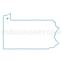
Erie City, Lawrence Park Township & Wesleyville Borough PUMA, Pennsylvania
About
Outline

Summary
| Unique Area Identifier | 193839 |
| Name | Erie City, Lawrence Park Township & Wesleyville Borough PUMA |
| State | Pennsylvania |
| Area (square miles) | 23.39 |
| Land Area (square miles) | 21.45 |
| Water Area (square miles) | 1.95 |
| % of Land Area | 91.67 |
| % of Water Area | 8.33 |
| Latitude of the Internal Point | 42.12166740 |
| Longtitude of the Internal Point | -80.06792640 |
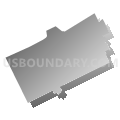
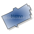
Maps

Graphs
Select a template below for downloading or customizing gragh for Erie City, Lawrence Park Township & Wesleyville Borough PUMA, Pennsylvania


Neighbors
Neighoring Public Use Microdata Area (by Name) Neighboring Public Use Microdata Area on the Map
Top 10 Neighboring County (by Population) Neighboring County on the Map
Top 10 Neighboring County Subdivision (by Population) Neighboring County Subdivision on the Map
- Erie city, Erie County, PA (101,786)
- Millcreek township, Erie County, PA (53,515)
- Harborcreek township, Erie County, PA (17,234)
- Lawrence Park township, Erie County, PA (3,982)
- Wesleyville borough, Erie County, PA (3,341)
- County subdivisions not defined, Erie County, PA (0)
Top 10 Neighboring Place (by Population) Neighboring Place on the Map
- Erie city, PA (101,786)
- Northwest Harborcreek CDP, PA (8,949)
- Lawrence Park CDP, PA (3,982)
- Wesleyville borough, PA (3,341)
Top 10 Neighboring Unified School District (by Population) Neighboring Unified School District on the Map
- Erie City School District, PA (101,798)
- Millcreek Township School District, PA (53,503)
- Harbor Creek School District, PA (17,234)
- Iroquois School District, PA (7,323)
- School District Not Defined (Water), PA (0)
Top 10 Neighboring State Legislative District Lower Chamber (by Population) Neighboring State Legislative District Lower Chamber on the Map
- State House District 2, PA (62,337)
- State House District 3, PA (60,723)
- State House District 4, PA (58,468)
- State House District 1, PA (55,982)
Top 10 Neighboring State Legislative District Upper Chamber (by Population) Neighboring State Legislative District Upper Chamber on the Map
Top 10 Neighboring 111th Congressional District (by Population) Neighboring 111th Congressional District on the Map
Top 10 Neighboring Census Tract (by Population) Neighboring Census Tract on the Map
- Census Tract 123, Erie County, PA (7,783)
- Census Tract 28, Erie County, PA (7,462)
- Census Tract 27, Erie County, PA (6,817)
- Census Tract 110.01, Erie County, PA (6,577)
- Census Tract 9, Erie County, PA (5,454)
- Census Tract 111.01, Erie County, PA (5,152)
- Census Tract 26, Erie County, PA (4,355)
- Census Tract 3, Erie County, PA (4,214)
- Census Tract 110.02, Erie County, PA (4,161)
- Census Tract 16, Erie County, PA (4,158)
Top 10 Neighboring 5-Digit ZIP Code Tabulation Area (by Population) Neighboring 5-Digit ZIP Code Tabulation Area on the Map
- 16509, PA (26,810)
- 16510, PA (25,625)
- 16506, PA (23,720)
- 16504, PA (17,322)
- 16505, PA (17,168)
- 16503, PA (16,850)
- 16502, PA (16,664)
- 16508, PA (16,050)
- 16511, PA (11,382)
- 16507, PA (11,088)